欢迎访问《汽车安全与节能学报》,

汽车安全与节能学报 ›› 2026, Vol. 17 ›› Issue (3): 279-295.DOI: 10.3969/j.issn.1674-8484.2026.03.001
• 综述与展望 • 下一篇
刘凯琪1( ), 康福祥1, 李伟1, 高博麟2
收稿日期:2025-09-25
修回日期:2026-04-24
出版日期:2026-06-30
发布日期:2026-07-02
作者简介:刘凯琪(1991—),女(汉),山西,副教授。E-mail:liukaiqi@bit.edu.cn。北京理工大学信息与电子学院长聘副教授、博士生导师。长期从事自动驾驶环境感知、激光雷达三维点云处理、目标检测与识别、激光雷达/高光谱/电磁多维度信号处理等方向基础理论方法及工程应用研究,主持国家自然科学基金面上/青年基金项目、国家实验室项目、全国重点实验室基金等国家级/省部级项目 10 余项,入选北京市青年人才托举工程。发表 SCI 等高水平论文 20 余篇,授权/受理发明专利 10 余项。研究成果发表于 IEEE Transactions on Pattern Analysis and Machine Intelligence、IEEE Transactions on Image Processing、IEEE Transactions on Geoscience and Remote Sensing、IEEE Transactions on Intelligent Transportation Systems等国际高水平期刊,以及 IEEE 计算机视觉与模式识别会议(IEEE Conference on Computer Vision and Pattern Recognition, CVPR)、欧洲计算机视觉会议(European Conference on Computer Vision, ECCV)、IEEE 智能交通系统国际会议(IEEE International Conference on Intelligent Transportation Systems,ITSC)等重要学术会议,部分成果入选 ESI 高被引论文。基金资助:
LIU Kaiqi1(), KANG Fuxiang1, LI Wei1, GAO Bolin2
Received:2025-09-25
Revised:2026-04-24
Online:2026-06-30
Published:2026-07-02
摘要:
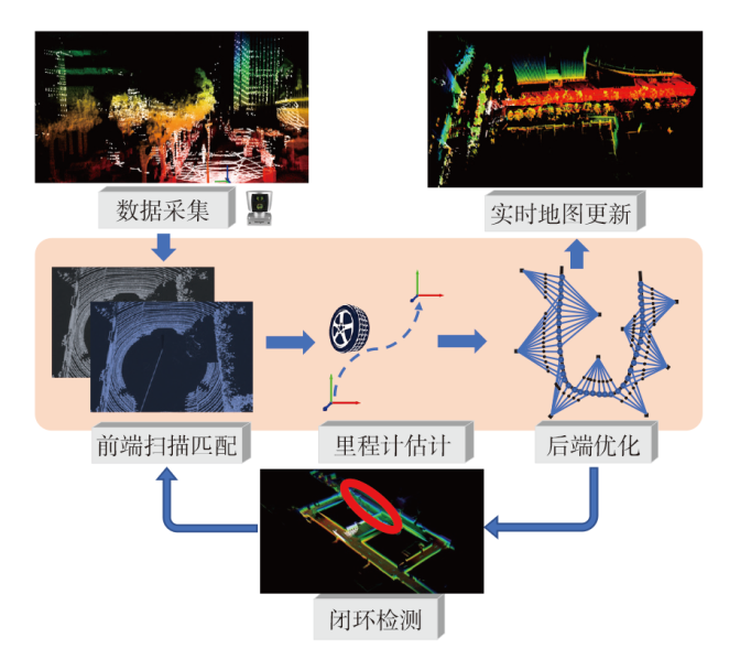
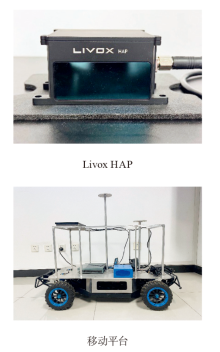
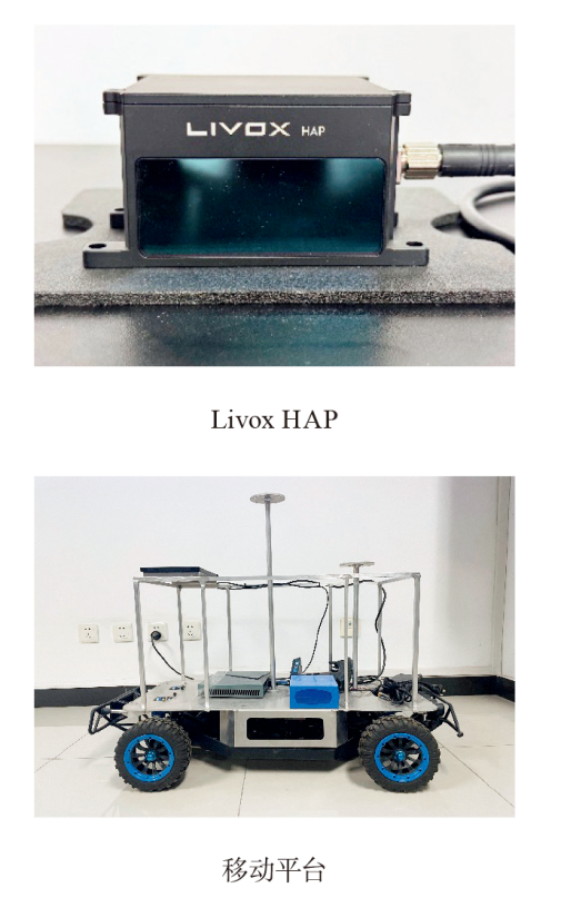
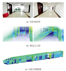
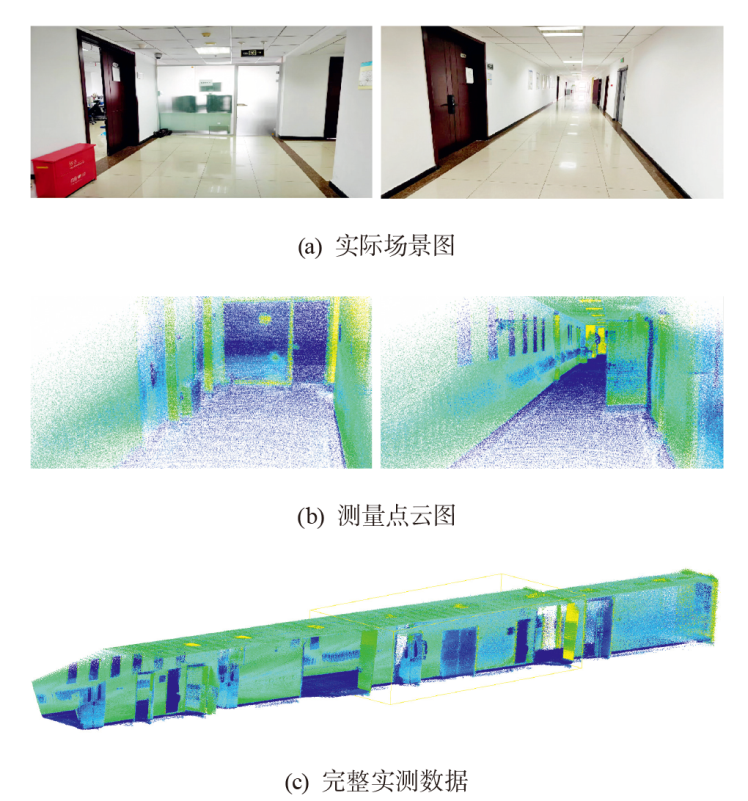
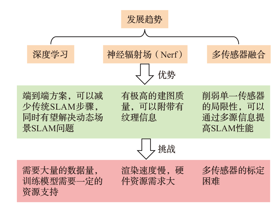
激光同时定位与地图构建(SLAM)作为机器人导航与环境感知的核心技术,已经广泛应用于自动驾驶、无人机、移动机器人等领域。该文概述了激光SLAM的基本框架与关键技术,重点介绍激光雷达的点云处理、前端数据配准、后端优化以及闭环检测步骤。梳理了经典的激光SLAM方法及对应的优化方法,讨论了其中的技术创新之处,揭示了激光SLAM技术由单一传感器驱动向多传感器融合、由传统几何约束向语义理解增强、由局部位姿估计向全局一致性优化不断发展的技术脉络与研究趋势。同时,开展了基于Livox HAP激光雷达的室内场景三维建图实验,验证了SLAM构建的高精度地图对环境感知任务的有效支撑。实验结果表明,基于激光SLAM获得的点云地图不仅能够较为准确地还原场景的空间结构,还能够为后续语义分割等任务提供可靠的数据基础,体现出激光SLAM在感知系统中的重要应用价值。最后,展望了激光SLAM在深度学习、神经辐射场和多传感器融合等方向的发展潜力,并指出其在动态环境适应、实时性与精度平衡以及系统工程化部署等方面仍面临挑战。
中图分类号:
刘凯琪, 康福祥, 李伟, 高博麟. 激光SLAM方法综述[J]. 汽车安全与节能学报, 2026, 17(3): 279-295.
LIU Kaiqi, KANG Fuxiang, LI Wei, GAO Bolin. Review of LiDAR-based SLAM methods[J]. Journal of Automotive Safety and Energy, 2026, 17(3): 279-295.
| 前端扫描匹配方法 | 优点 | 缺点 |
|---|---|---|
| ICP算法及其扩展算法 | 在较好的初始值下,收敛快 | 对噪声和初始条件敏感 |
| 相关性扫描匹配方法 | 全局暴力搜索,对噪声不敏感 | 资源消耗大,速度慢 |
| 正态分布变换方法 | 对噪声不敏感,能处理大型点云数据 | Gauss分布假设不成立时效果差 |
| 基于特征的匹配方法 | 具有旋转和缩放不变性 | 依赖特征提取方法的选择 |
| 前端扫描匹配方法 | 优点 | 缺点 |
|---|---|---|
| ICP算法及其扩展算法 | 在较好的初始值下,收敛快 | 对噪声和初始条件敏感 |
| 相关性扫描匹配方法 | 全局暴力搜索,对噪声不敏感 | 资源消耗大,速度慢 |
| 正态分布变换方法 | 对噪声不敏感,能处理大型点云数据 | Gauss分布假设不成立时效果差 |
| 基于特征的匹配方法 | 具有旋转和缩放不变性 | 依赖特征提取方法的选择 |
| 方法类型 | 方法与特征 | 优缺点 | 适用场景 |
|---|---|---|---|
| 栅格地图 | 将空间离散成网格,使用Bayes滤波等方法更新栅格的占据概率 | 表示直观,建图稳定;二维表示,难适应三维环境 | 早期SLAM系统,简单环境建图 |
| 稠密点云地图 | 拼接连续激光点云,获得高精细三维模型 | 精度高,细节丰富;计算和存储开销大 | 自动驾驶、三维建模 |
| 稀疏点云地图 | 提取关键特征(角点、边缘等)建图 | 计算效率高,占用资源低;细节表达能力弱 | 移动机器人、资源受限场景 |
| 八叉树地图 | 使用递归空间划分,构建占据概率的三维地图 | 存储高效,支持实时更新;结构复杂,构建较难 | 三维建图、长期运行系统 |
| 增量式建图 | 在运动过程中持续更新地图,实现动态扩展 | 支持实时性,适应大场景;易积累误差,需配合闭环优化 | 室外导航、动态环境 |
| 层次化/多分辨率地图 | 地图分为粗细2层,全局结构+局部高分辨率细节 | 效率与精度平衡;设计复杂,参数多 | 大规模环境建图 |
| 语义地图 | 融合语义分割与几何信息,提升地图表达能力 | 具备环境语义理解能力;训练代价高 | 服务机器人、人机交互场景 |
| 方法类型 | 方法与特征 | 优缺点 | 适用场景 |
|---|---|---|---|
| 栅格地图 | 将空间离散成网格,使用Bayes滤波等方法更新栅格的占据概率 | 表示直观,建图稳定;二维表示,难适应三维环境 | 早期SLAM系统,简单环境建图 |
| 稠密点云地图 | 拼接连续激光点云,获得高精细三维模型 | 精度高,细节丰富;计算和存储开销大 | 自动驾驶、三维建模 |
| 稀疏点云地图 | 提取关键特征(角点、边缘等)建图 | 计算效率高,占用资源低;细节表达能力弱 | 移动机器人、资源受限场景 |
| 八叉树地图 | 使用递归空间划分,构建占据概率的三维地图 | 存储高效,支持实时更新;结构复杂,构建较难 | 三维建图、长期运行系统 |
| 增量式建图 | 在运动过程中持续更新地图,实现动态扩展 | 支持实时性,适应大场景;易积累误差,需配合闭环优化 | 室外导航、动态环境 |
| 层次化/多分辨率地图 | 地图分为粗细2层,全局结构+局部高分辨率细节 | 效率与精度平衡;设计复杂,参数多 | 大规模环境建图 |
| 语义地图 | 融合语义分割与几何信息,提升地图表达能力 | 具备环境语义理解能力;训练代价高 | 服务机器人、人机交互场景 |
| 经典方法 | 扩展方法/出处文献 | 特点 |
|---|---|---|
| Cartographer [ | 大规模建图场景下的基于LiDAR的实时闭环检测方法 | |
| 蔡芸,等[ | 语义信息改进重定位 | |
| 沈欣,等[ | 速度积分位姿融合 | |
| LOAM[ | 将激光雷达的位姿估计与环境建图解耦为两个相对独立的计算单元 | |
| VLOAM [ | 融合视觉里程计和激光雷达里程计 | |
| LIMO [ | 激光雷达的深度信息与单目视觉的特征追踪能力结合 | |
| LeGO-LOAM [ | 引入轻量化、增加闭环检测 | |
| ZHANG Ji,et al [ | 集成激光雷达、视觉和惯性测量单元 | |
| LLOAM [ | 优化闭环检测、后端采用GTSAM 4.0因子图优化 | |
| LIOM [ | 针对高速环境优化 | |
| LOAM_livox [ | 针对小视场激光雷达的LOAM算法 | |
| F-LOAM [ | 针对计算有限的机器人平台进行轻量化 | |
| Hector-SLAM [ | 低计算资源下的高效定位与建图 | |
| ZHANG Yong,et al [ | 结合L-M优化和贝塞尔平滑动态加权A算法 | |
| 汪建华,等[ | 采用插值法和扩展Kalman法提高精度 | |
| 苏易衡,等[ | 降低对激光雷达精度和刷新频率的依赖 | |
| LIO-SAM [ | 紧耦合的激光雷达惯性里程计系统 | |
| WANG Ji,et al [ | 引入基于强度扫描上下文改进 | |
| MENG Xinyu,et al [ | 解决高度动态和无结构环境中的应用问题 | |
| Faster-LIO [ | 引入增量体素的激光惯性里程计方法 | |
| FAST-LIO2 [ | 引入高效的紧耦合迭代卡尔曼滤波器 | |
| 其他方法 | IMLS-SLAM [ | 仅依赖3D LiDAR数据进行定位和建图 |
| Barrau A,et al [ | 不变EKF在SLAM的应用 | |
| FastSLAM [ | 粒子滤波和Rao-Blackwellized滤波的应用 | |
| Gmapping [ | 基于FastSLAM 的高效2D SLAM 算法 | |
| Grisetti G,et al [ | 优化rao-blackwelized粒子滤波器 |
| 经典方法 | 扩展方法/出处文献 | 特点 |
|---|---|---|
| Cartographer [ | 大规模建图场景下的基于LiDAR的实时闭环检测方法 | |
| 蔡芸,等[ | 语义信息改进重定位 | |
| 沈欣,等[ | 速度积分位姿融合 | |
| LOAM[ | 将激光雷达的位姿估计与环境建图解耦为两个相对独立的计算单元 | |
| VLOAM [ | 融合视觉里程计和激光雷达里程计 | |
| LIMO [ | 激光雷达的深度信息与单目视觉的特征追踪能力结合 | |
| LeGO-LOAM [ | 引入轻量化、增加闭环检测 | |
| ZHANG Ji,et al [ | 集成激光雷达、视觉和惯性测量单元 | |
| LLOAM [ | 优化闭环检测、后端采用GTSAM 4.0因子图优化 | |
| LIOM [ | 针对高速环境优化 | |
| LOAM_livox [ | 针对小视场激光雷达的LOAM算法 | |
| F-LOAM [ | 针对计算有限的机器人平台进行轻量化 | |
| Hector-SLAM [ | 低计算资源下的高效定位与建图 | |
| ZHANG Yong,et al [ | 结合L-M优化和贝塞尔平滑动态加权A算法 | |
| 汪建华,等[ | 采用插值法和扩展Kalman法提高精度 | |
| 苏易衡,等[ | 降低对激光雷达精度和刷新频率的依赖 | |
| LIO-SAM [ | 紧耦合的激光雷达惯性里程计系统 | |
| WANG Ji,et al [ | 引入基于强度扫描上下文改进 | |
| MENG Xinyu,et al [ | 解决高度动态和无结构环境中的应用问题 | |
| Faster-LIO [ | 引入增量体素的激光惯性里程计方法 | |
| FAST-LIO2 [ | 引入高效的紧耦合迭代卡尔曼滤波器 | |
| 其他方法 | IMLS-SLAM [ | 仅依赖3D LiDAR数据进行定位和建图 |
| Barrau A,et al [ | 不变EKF在SLAM的应用 | |
| FastSLAM [ | 粒子滤波和Rao-Blackwellized滤波的应用 | |
| Gmapping [ | 基于FastSLAM 的高效2D SLAM 算法 | |
| Grisetti G,et al [ | 优化rao-blackwelized粒子滤波器 |
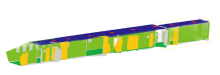
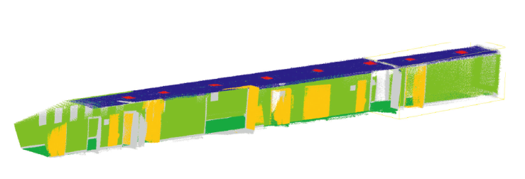
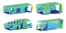
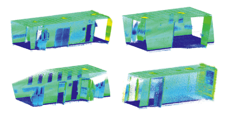
| 编号 | 类别 | 颜色 | 训练区域(点数) | 测试区域(点数) |
|---|---|---|---|---|
| 1 | 天花板 | 蓝色 | 259 883 | 83 571 |
| 2 | 地板 | 绿色 | 474 097 | 163 083 |
| 3 | 墙 | 黄绿色 | 3 675 802 | 1 445 094 |
| 4 | 门 | 橙色 | 1 259 442 | 452 910 |
| 5 | 灯 | 红色 | 14 571 | 4 025 |
| 6 | 未标记 | 灰色 | 1 760 796 | 169230 |
| 编号 | 类别 | 颜色 | 训练区域(点数) | 测试区域(点数) |
|---|---|---|---|---|
| 1 | 天花板 | 蓝色 | 259 883 | 83 571 |
| 2 | 地板 | 绿色 | 474 097 | 163 083 |
| 3 | 墙 | 黄绿色 | 3 675 802 | 1 445 094 |
| 4 | 门 | 橙色 | 1 259 442 | 452 910 |
| 5 | 灯 | 红色 | 14 571 | 4 025 |
| 6 | 未标记 | 灰色 | 1 760 796 | 169230 |
| 方法 | 天花板 | 地板 | 墙 | 门 | 灯 | mIoU | OA | mAcc | Avg.F1 |
|---|---|---|---|---|---|---|---|---|---|
| PointNet | 80.4 | 95.1 | 87.3 | 37.2 | 6.3 | 61.3 | 89.9 | 68.1 | 68.6 |
| PointNet++ | 84.6 | 99.0 | 84.2 | 21.4 | 70.0 | 71.8 | 89.9 | 80.4 | 80.0 |
| PTv1 | 86.0 | 98.9 | 91.8 | 59.9 | 74.6 | 82.2 | 94.2 | 88.4 | 89.6 |
| PTv2 | 83.9 | 99.1 | 91.1 | 61.8 | 76.5 | 82.5 | 94.0 | 88.1 | 89.8 |
| 方法 | 天花板 | 地板 | 墙 | 门 | 灯 | mIoU | OA | mAcc | Avg.F1 |
|---|---|---|---|---|---|---|---|---|---|
| PointNet | 80.4 | 95.1 | 87.3 | 37.2 | 6.3 | 61.3 | 89.9 | 68.1 | 68.6 |
| PointNet++ | 84.6 | 99.0 | 84.2 | 21.4 | 70.0 | 71.8 | 89.9 | 80.4 | 80.0 |
| PTv1 | 86.0 | 98.9 | 91.8 | 59.9 | 74.6 | 82.2 | 94.2 | 88.4 | 89.6 |
| PTv2 | 83.9 | 99.1 | 91.1 | 61.8 | 76.5 | 82.5 | 94.0 | 88.1 | 89.8 |
| [1] | 刘洋, 占佳豪, 李深, 等. 自动驾驶技术的未来:单车智能和智能车路协同[J]. 汽车安全与节能学报, 2024, 15(5): 611-633. |
| LIU Yang, ZHAN Jiahao, LI Shen, et al. Future of autono-mous driving: Single autonomous driving and intelligent vehicle-infrastructure collaboration systems[J]. J Autom Safe Energ, 2024, 15(5): 611-633. (in Chinese) | |
| [2] |
杨蒙蒙, 江昆, 温拓朴, 等. 自动驾驶高精度地图众源更新技术现状与挑战[J]. 中国公路学报, 2023, 36(5): 244-259.
doi: 10.19721/j.cnki.1001-7372.2023.05.021 |
|
YANG Mengmeng, JIANG Kun, WEN Tuopu, et al. Current status and challenges of crowdsourced updating technology for high-precision maps in autonomous driving[J]. Chin J Highw Transport, 2023, 36(5): 244-259. (in Chinese)
doi: 10.19721/j.cnki.1001-7372.2023.05.021 |
|
| [3] | QIN Tong, CHEN Tongqing, CHEN Yilun, et al. Avp-slam:Semantic visual mapping and localization for autonomous vehicles in the parking lot [C]// 2020 IEEE/RSJ Int’l Conf Intel Robo Syst (IROS). IEEE, 2020: 5939-5945. |
| [4] | QIN Tong, ZHENG Yuxin, CHEN Tongqing, et al. A light-weight semantic map for visual localization towards auto-nomous driving [C]// 2021 IEEE Int’l Conf Robo Auto (ICRA). IEEE, 2021: 11248-11254. |
| [5] | ZHENG Han, ZHANG Jiale, JIANG Mingyang, et al. Embodied escaping: End-to-end reinforcement learning for robot navigation in narrow environment[J]. arXiv preprint arXiv: 2503.03208, 2025. |
| [6] | 张亮, 刘智宇, 曹晶瑛, 等. 扫地机器人增强位姿融合的Cartographer算法及系统实现[J]. 软件学报, 2020, 31(9): 2678-2690. |
| ZHANG Liang, LIU Zhiyu, CAO Jingying, et al. Carto-grapher algorithm and system implementation with enhanced pose fusion for sweeping robots[J]. J Software, 2020, 31(9): 2678-2690. (in Chinese) | |
| [7] | 大疆创新. 禅思L2 [EB/OL]. 大疆创新. [2025-09-19] https://enterprise.dji.com/cn/zenmuse-l2. |
| DJI. Zenmuse L2 [EB/OL]. DJI. [2025-09-19] https://enterprise.dji.com/cn/zenmuse-l2. (in Chinese) | |
| [8] | YUE Xiangdi, ZHANG Yihuan, CHEN Jiawei, et al. LiDAR-based SLAM for robotic mapping: state of the art and new frontiers[J]. Indu Robo:Int’l J Robo Res Appl, 2024, 51(2): 196-205. |
| [9] |
刘铭哲, 徐光辉, 唐堂, 等. 激光雷达SLAM算法综述[J]. 计算机工程与应用, 2024, 60(1): 1-14.
doi: 10.3778/j.issn.1002-8331.2308-0455 |
| LIU Mingzhe, XU Guanghui, TANG Tang, et al. A review of LiDAR SLAM algorithms[J]. Comput Engi Appl, 2024, 60(1): 1-14. (in Chinese) | |
| [10] | 大疆创新. Horizon户外数据包[EB/OL]. 大疆创新. [2025-09-19] https://terra-1-g.djicdn.com/65c028cd298f4669a7f0e40e50ba1131/Showcase/horizon_outdoor.bag. |
| DJI. Horizon outdoor data bag[EB/OL]. DJI. [2025-09-19] https://terra-1-g.djicdn.com/65c028cd298f4669a7f0e40e50ba1131/Showcase/horizon_outdoor.bag. (in Chinese) | |
| [11] | Besl P J, McKay N D. Method for registration of 3-D shapes[C]// Sens Fusi IV: Contr Parad Data Struct. Spie, 1992, 1611: 586-606. |
| [12] | Censi A. An ICP variant using a point-to-line metric[C]// 2008 IEEE Int’l Conf Robo Auto. IEEE, 2008: 19-25. |
| [13] | Low K L. Linear least-squares optimization for point-to-plane ICP surface registration[J]. Chapel Hill, Univ North Carolina, 2004, 4(10): 1-3. |
| [14] | Segal A, Haehnel D, Thrun S. Generalized-ICP[C]// Robo: Sci Syst. Seattle, WA.2009, 2(4): 435. |
| [15] | Serafin J, Grisetti G. NICP:Dense normal based point cloud registration [C]// 2015 IEEE/RSJ Int’l Conf Intel Robo Syst (IROS). IEEE, 2015: 742-749. |
| [16] | Olson E B. Real-time correlative scan matching[C]// 2009 IEEE Int’l Conf Robo Auto. IEEE, 2009: 4387-4393. |
| [17] | Magnusson M, Andreasson H, Nuchter A, et al. Appearance-based loop detection from 3D laser data using the normal distributions transform[C]// 2009 IEEE Int’l Conf Robo Auto. IEEE, 2009: 23-28. |
| [18] | 周治国, 曹江微, 邸顺帆. 3D 激光雷达 SLAM 算法综述[J]. 仪器仪表学报, 2021, 42(9): 13-27. |
| ZHOU Zhiguo, CAO Jiangwei, DI Shunfan. A review of 3D LiDAR SLAM algorithms[J]. Chin J Sci Instrum, 2021, 42(9): 13-27. (in Chinese) | |
| [19] | 刘剑, 白迪. 基于特征匹配的三维点云配准算法[J]. 光学学报, 2018, 38(12): 1215005. |
| LIU Jian, BAI Di. Three-dimensional point cloud registra-tion algorithm based on feature matching[J]. Acta Opti Sini, 2018, 38(12): 1215005. (in Chinese) | |
| [20] | WU Ming, CHENG Chao, SHANG Huiliang. 2d lidar slam based on Gauss-Newton[C]// 2021 Int’l Conf Netw Syst AI (INSAI). IEEE, 2021: 90-94. |
| [21] | ZHANG Kang, DONG Chaoyi, GAO Liangliang, et al. A graph-optimized SLAM with improved Levenberg-Marquardt algorithm[C]// 2023 9th Int’l Conf Contr, Deci Info Tech (CoDIT). IEEE, 2023: 1821-1825. |
| [22] | LYU Pengfei, GUO Jia, SHA Qixin, et al. The comparison of gauss-newton and dog-leg in isam for AUV [C]// 2019 IEEE Underw Tech (UT). IEEE, 2019: 1-4. |
| [23] | DU Yongquan. G2o[EB/OL]. G2O Tutorial. [2025-09-19] https://ltslam-doc.readthedocs.io/en/latest/tutorial/g2o/g2o_tutorial.html. |
| [24] | Google. Ceres-solver[EB/OL]. Google. [2025-09-19] http://ceres-solver.org/. |
| [25] | ZHENG Tiantian, FENG Wang, XU Zhengyueang. An improved Gtsam-based nonlinear optimization algorithm in ORBSLAM3[C]// 2022 Int’l Conf Intel Transport, Big Data Smart City (ICITBS). IEEE, 2022: 30-33. |
| [26] | Bailey T, Nieto J, Guivant J, et al. Consistency of the EKF-SLAM algorithm[C]// 2006 IEEE/RSJ Int’l Conf Intel Robo Syst. IEEE, 2006: 3562-3568. |
| [27] | QI Song, HAN Jianda. An adaptive UKF algorithm for the state and parameter estimations of a mobile robot[J]. Acta Auto Sini, 2008, 34(1): 72-79. |
| [28] | Abdelrasoul Y, Saman A B S H M, Sebastian P. A quanti-tative study of tuning ROS gmapping parameters and their effect on performing indoor 2D SLAM [C]// 2016 2nd IEEE Int’l Symp Robo Manufact Auto (ROMA). IEEE, 2016: 1-6. |
| [29] | Kaess M, Ranganathan A, Dellaert F. iSAM: Incremental smoothing and mapping[J]. IEEE Trans Robo, 2008, 24(6): 1365-1378. |
| [30] | Kaess M, Johannsson H, Roberts R, et al. iSAM2: Incre-mental smoothing and mapping using the Bayes tree[J]. Int’l J Robo Res, 2012, 31(2): 216-235. |
| [31] | Cummins M J, Newman P M. Fab-map:Appearance-based place recognition and mapping using a learned visual vocabulary model [C]// Proc 27th Int’l Conf Mach Learn (ICML-10). Haifa, Israel. 2010: 3-10. |
| [32] | Dubé R, Dugas D, Stumm E, et al. Segmatch:Segment based place recognition in 3d point clouds [C]// 2017 IEEE Int’l Conf Robo Auto (ICRA). IEEE, 2017: 5266-5272. |
| [33] | Kim G, Kim A. Scan context:Egocentric spatial descriptor for place recognition within 3d point cloud map [C]// 2018 IEEE/RSJ Int’l Conf Intel Robo Syst (IROS). IEEE, 2018: 4802-4809. |
| [34] | Kim G, Choi S, Kim A. Scan context++: Structural place recognition robust to rotation and lateral variations in urban environments[J]. IEEE Trans Robo, 2021, 38(3): 1856-1874. |
| [35] | SHAN Tixiao, Englot B, Duarte F, et al. Robust place recognition using an imaging lidar [C]// 2021 IEEE Int’l Conf Robo Auto (ICRA). IEEE, 2021: 5469-5475. |
| [36] | Campos C, Elvira R, Rodríguez J J G, et al. Orb-slam3: An accurate open-source library for visual, visual-inertial, and multimap slam[J]. IEEE Trans Robo, 2021, 37(6): 1874-1890. |
| [37] | 李升波, 关阳, 侯廉, 等. 深度神经网络的关键技术及其在自动驾驶领域的应用[J]. 汽车安全与节能学报, 2019, 10(2): 119-145. |
| LI Shengbo, GUAN Yang, HOU Lian, et al. Key technique of deep neural network and its applications in autonomous driving[J]. J Autom Safe Energ, 2019, 10(2): 119-145. (in Chinese) | |
| [38] | CHEN Xieyuanli, Läbe T, Milioto A, et al. OverlapNet: Loop closing for LiDAR-based SLAM[J]. arXiv preprint arXiv: 2105.11344, 2021. |
| [39] | MA Junyi, ZHANG Jun, XU Jintao, et al. Overlaptrans-former: An efficient and yaw-angle-invariant transformer network for lidar-based place recognition[J]. IEEE Robo Auto Lett, 2022, 7(3): 6958-6965. |
| [40] | Cattaneo D, Vaghi M, Valada A. Lcdnet: Deep loop closure detection and point cloud registration for lidar slam[J]. IEEE Trans Robo, 2022, 38(4): 2074-2093. |
| [41] | Moravec H, Elfes A. High resolution maps from wide angle sonar[C]// Proc. 1985 IEEE Int’l Conf Robo Auto. IEEE, 1985, 2: 116-121. |
| [42] | Newcombe R A, Lovegrove S J, Davison A J. DTAM: Dense tracking and mapping in real-time[C]// 2011 Int’l Conf Comput Visi. IEEE, 2011: 2320-2327. |
| [43] | Informatik IX Computer Vision Group. RGBD-dataset[EB/OL]. TUM. [2025-09-19] https://cvg.cit.tum.de/data/datasets/rgbd-dataset. |
| [44] | Mur-Artal R, Montiel J M M, Tardos J D. ORB-SLAM: a versatile and accurate monocular SLAM system[J]. IEEE Trans Robo, 2015, 31(5): 1147-1163. |
| [45] | Hornung A, Wurm K M, Bennewitz M, et al. OctoMap: An efficient probabilistic 3D mapping framework based on octrees[J]. Auton Robo, 2013, 34: 189-206. |
| [46] | DENG Junyuan, WU Qi, CHEN Xieyuanli, et al. Nerf-loam: Neural implicit representation for large-scale incremental lidar odometry and mapping[C]// Proc IEEE/CVF Int’l Conf Comput Visi. 2023: 8218-8227. |
| [47] | LI Qi, WANG Yue, WANG Yilun, et al. Hdmapnet:An online HD map construction and evaluation framework [C]// 2022 Int’l Conf Robo Auto (ICRA). IEEE, 2022: 4628-4634. |
| [48] | Hess W, Kohler D, Rapp H, et al. Real-time loop closure in 2D LIDAR SLAM [C]// 2016 IEEE Int’l Conf Robo Auto (ICRA). IEEE, 2016: 1271-1278. |
| [49] | ZHANG Ji, Singh S. LOAM: Lidar odometry and mapping in real-time[C]// Robo: Sci Syst, Berkeley, CA. 2014, 2(9): 1-9. |
| [50] | Kohlbrecher S, Von Stryk O, Meyer J, et al. A flexible and scalable SLAM system with full 3D motion estimation[C]// 2011 IEEE Int’l Symp Safe, Secu, Resc Robo. IEEE, 2011: 155-160. |
| [51] | SHAN Tixiao, Englot B, Meyers D, et al. Lio-sam:Tightly-coupled lidar inertial odometry via smoothing and mapping [C]// 2020 IEEE/RSJ Int’l Conf Intel Robo Syst (IROS). IEEE, 2020: 5135-5142. |
| [52] | 蔡芸, 曾超, 王磊, 等. 语义先验改进Cartographer的机器人重定位方法[J]. 农业机械学报, 2025, 56(6): 585-593, 683. |
| CAI Yun, ZENG Chao, WANG Lei, et al. Semantic prior enhanced robot relocation method for cartographer[J]. Trans Chin Soc Agri Mach, 2025, 56(6): 585-593, 683. (in Chinese) | |
| [53] | 沈欣, 闵华松. 基于速度积分位姿融合的改进Cartographer算法[J]. 应用激光, 2021, 41(5): 1063-1069. |
| SHEN Xin, MIN Huasong. An improved cartographer algorithm based on velocity integration pose fusion[J]. Appl Lase, 2021, 41(5): 1063-1069. (in Chinese) | |
| [54] | ZHANG Ji, Singh S. Visual-lidar odometry and mapping: Low-drift, robust, and fast [C]// 2015 IEEE Int’l Conf Robo Auto (ICRA). IEEE, 2015: 2174-2181. |
| [55] | Graeter J, Wilczynski A, Lauer M. Limo:Lidar-monocular visual odometry [C]// 2018 IEEE/RSJ Int’l Conf Intel Robo Syst (IROS). IEEE, 2018: 7872-7879. |
| [56] | SHAN Tixiao, Englot B. Lego-loam:Lightweight and ground-optimized lidar odometry and mapping on variable terrain [C]// 2018 IEEE/RSJ Int’l Conf Intel Robo Syst (IROS). IEEE, 2018: 4758-4765. |
| [57] | ZHANG JI, Singh S. Laser-visual-inertial odometry and mapping with high robustness and low drift[J]. J Field Robo, 2018, 35(8): 1242-1264. |
| [58] | JI Xingliang, ZUO Lin, ZHANG Changhua, et al. Lloam:Lidar odometry and mapping with loop-closure detection based correction [C]// 2019 IEEE Int’l Conf Mech Auto (ICMA). IEEE, 2019: 2475-2480. |
| [59] | ZHAO Shibo, FANG Zheng, LI HaoLai, et al. A robust laser-inertial odometry and mapping method for large-scale highway environments [C]// 2019 IEEE/RSJ Int’l Conf Intel Robo Syst (IROS). IEEE, 2019: 1285-1292. |
| [60] | LIN Jiarong, ZHANG Fu. Loam livox: A fast, robust, high-precision LiDAR odometry and mapping package for LiDARs of small FoV [C]// 2020 IEEE Int’l Conf Robo Auto (ICRA). IEEE, 2020: 3126-3131. |
| [61] | WANG Han, WANG Chen, CHNE Chunlin, et al. F-loam:Fast lidar odometry and mapping [C]// 2021 IEEE/RSJ Int’l Conf Intel Robo Syst (IROS). IEEE, 2021: 4390-4396. |
| [62] | Kohlbrecher S, Meyer J. ROS. hector_slam[EB/OL]. ROS. [2025-09-19] https://wiki.ros.org/hector_slam. |
| [63] |
ZHANG Yong, LI Renjie, WANG Fenghong, et al. An autonomous navigation strategy based on improved hector slam with dynamic weighted a* algorithm[J]. IEEE Access, 2023, 11: 79553-79571.
doi: 10.1109/ACCESS.2023.3299293 URL |
| [64] | 汪建华, 黄磊, 石雨婷, 等. 基于优化Hector-SLAM算法的机器人自主导航系统设计[J]. 工程设计学报, 2023, 30(6): 678-686. |
| WANG Jianhua, HUANG Lei, SHI Yuting, et al. Design of robot autonomous navigation system based on optimized hector-SLAM algorithm[J]. J Engi Desi, 2023, 30(6): 678-686. (in Chinese) | |
| [65] | 苏易衡, 张奇志, 周亚丽. 适用于低端激光雷达的优化 Hector SLAM 算法[J]. 实验室研究与探索, 2019, 38(9): 47-51. |
| SU Yiheng, ZHANG Qizhi, ZHOU Yali. An optimized hector SLAM algorithm suitable for low-end LiDARs[J]. Res Expl Lab, 2019, 38(9): 47-51. (in Chinese) | |
| [66] | WANG Chao, ZHANG Guobao, ZHANG Ming. Research on improving LIO-SAM based on intensity scan context[C]// J Phys: Conf Seri. IOP Publishing, 2021, 1827(1): 012193. |
| [67] | MENG Xinyu, CHEN Xi, CHEN Shaofeng, et al. An improved LIO-SAM algorithm by integrating image information for dynamic and unstructured environments[J]. Measu Sci Tech, 2024, 35(9): 96313. |
| [68] | BAI Chunge, XIAO Tao, CHEN Yajie, et al. Faster-LIO: Lightweight tightly coupled LiDAR-inertial odometry using parallel sparse incremental voxels[J]. IEEE Robo Auto Lett, 2022, 7(2): 4861-4868. |
| [69] | XU Wei, CAI Yixi, HE Dongjiao, et al. Fast-lio2: Fast direct lidar-inertial odometry[J]. IEEE Trans Robo, 2022, 38(4): 2053-2073. |
| [70] | Deschaud J E. IMLS-SLAM:Scan-to-model matching based on 3D data [C]// 2018 IEEE Int’l Conf Robo Auto (ICRA). IEEE, 2018: 2480-2485. |
| [71] | Barrau A, Bonnabel S. An EKF-SLAM algorithm with consistency properties[J]. arXiv preprint arXiv:1510.06263, 2015. |
| [72] | Montemerlo M, Thrun S, Koller D, et al. FastSLAM: A factored solution to the simultaneous localization and mapping problem[J]. AAAI/IAAI, 2002, 593598: 593-598. |
| [73] | Grisetti G, Stachniss C, Burgard W. Improved techniques for grid mapping with rao-blackwellized particle filters[J]. IEEE Trans Robo, 2007, 23(1): 34-46. |
| [74] | Grisetti G, Tipaldi G D, Stachniss C, et al. Fast and accurate SLAM with Rao-Blackwellized particle filters[J]. Robo Auto Syst, 2007, 55(1): 30-38. |
| [75] | LIVOX. livox-hap[EB/OL]. LIVOX. [2025-09-19] https://www.livoxtech.com/hap. |
| [76] | Qi C R, SU Hao, MO Kaichun, et al. Pointnet: Deep learning on point sets for 3d classification and segmentation[C]// Proc IEEE Conf Comput Visi Patt Recog. 2017: 652-660. |
| [77] | Ruizhongtai Q C, YI Li, SU Hao, et al. Pointnet++: Deep hierarchical feature learning on point sets in a metric space[J]. Advan Neur Info Proc Syst, 2017, 30: 5105-5114. |
| [78] | ZHAO Hengshuang, JIANG Li, JIA Jiaya, et al. Point transformer[C]// Proc IEEE/CVF Int’l Conf Comput Visi. Held Virtually. 2021: 16259-16268. |
| [79] | WU Xiaoyang, LAO Yixing, JIANG Li, et al. Point transformer V2: Grouped vector attention and partition-based pooling[J]. Advan Neur Info Proc Syst, 2022, 35: 33330-33342. |
| [80] | 王海, 徐岩松, 蔡英凤, 等. 基于多传感器融合的智能汽车多目标检测技术综述[J]. 汽车安全与节能学报, 2021, 12(4): 440-455. |
| WANG Hai, XU Yansong, CAI Yingfeng, et al. Overview of intelligent vehicle multi-target detection technology based on multi-sensor fusion[J]. J Autom Safe Energ, 2021, 12(4): 440-455. (in Chinese) | |
| [81] | ZHANG Xiao, LI Shuaixin. SL-SLAM: A robust visual-inertial SLAM based deep feature extraction and matching[J]. arXiv e-prints, 2024: arXiv: 2405.03413. |
| [82] | Quach C H, Phung M D, Le H V, et al. SupSLAM:A robust visual inertial SLAM system using SuperPoint for unmanned aerial vehicles [C]// 2021 8th NAFOSTED Conf Info Comput Sci (NICS). IEEE, 2021: 507-512. |
| [83] | DeTone D, Malisiewicz T, Rabinovich A. Superpoint: Self-supervised interest point detection and description[C]// Proc IEEE Conf Comput Visi Patt Recog Worksh. Salt Lake City, UT.2018: 224-236. |
| [84] | Xieyuanli C, Milioto A, Palazzolo E, et al. Suma++:Efficient lidar-based semantic slam [C]// 2019 IEEE/RSJ Int’l Conf Intel Robo Syst (IROS). IEEE, 2019: 4530-4537. |
| [85] | Milioto A, Vizzo I, Behley J, et al. Rangenet++:Fast and accurate lidar semantic segmentation [C]// 2019 IEEE/RSJ Int’l Conf Intel Robo Syst (IROS). IEEE, 2019: 4213-4220. |
| [86] | HE Yicheng, CHEN Guangcheng, ZHANG Hong. Optimi-zing NeRF-based SLAM with Trajectory Smoothness Constraints[J]. arXiv preprint arXiv:2410.08780, 2024. |
| [87] | WANG Peng, ZHAO Lingzhe, ZHANG Yin, et al. MBA-SLAM: Motion blur aware dense visual SLAM with radiance fields representation[J]. arXiv preprint arXiv:2411.08279, 2024. |
| [88] | Chung C M, Tseng Y C, Hsu Y C, et al. Orbeez-slam:A real-time monocular visual slam with ORB features and nerf-realized mapping [C]// 2023 IEEE Int’l Conf Robo Auto (ICRA). IEEE, 2023: 9400-9406. |
| [89] | Isaacson S, Kung P C, Ramanagopal M, et al. Loner: Lidar only neural representations for real-time slam[J]. IEEE Robo Auto Lett, 2023, 8(12): 8042-8049. |
| [90] | TAO Yifu, Bhalgat Y, Fu L F T, et al. SiLVR:Scalable LiDAR-visual reconstruction with neural radiance fields for robotic inspection [C]// 2024 IEEE Int’l Conf Robo Auto (ICRA). IEEE, 2024: 17983-17989. |
| [91] | 张顺, 李雪娇, 覃小婷, 等. 基于多传感器融合技术 SLAM 的研究[J]. 汽车实用技术, 2025, 50(4): 16-19. |
| ZHANG Shun, LI Xuejiao, QIN Xiaoting, et al. Research on SLAM based on multi-sensor fusion technology[J]. Autom Appl Tech, 2025, 50(4): 16-19. (in Chinese) | |
| [92] | YIN Jie, LI Ang, XI Wei, et al. Ground-fusion:A low-cost ground slam system robust to corner cases [C]// 2024 IEEE Int’l Conf Robo Auto (ICRA). IEEE, 2024: 8603-8609. |
| [1] | 石丽英, 周国峰, 李泽星, 曹莉凌. 基于3DSSD的差异路口自适应联邦学习算法[J]. 汽车安全与节能学报, 2024, 15(5): 732-741. |
| [2] | 李茂月, 吕虹毓, 河香梅, 徐光岐, 于伟. 自动驾驶中周围车辆识别与信息地图构建技术[J]. 汽车安全与节能学报, 2022, 13(1): 131-141. |
| [3] | 时培成, 杨剑锋, 梁涛年, 齐恒. 基于阈值自适应调整的图像特征均匀分布ORB算法改进[J]. 汽车安全与节能学报, 2021, 12(3): 305-313. |
| 阅读次数 | ||||||
|
全文 |
|
|||||
|
摘要 |
|
|||||
